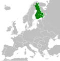
Афаил:Republic of Finland (1942).svg

Ахалагаратә фаил (SVG афаил, номиналла 450 × 456 апиксельқәа, афаил ашәагаа: 500 КБ)
| Ари фаил Wikimedia Commons. Афаилтә информациа |
Афаил адаҟьа |
Краткие подписи
Элементы, изображённые на этом файле
изображённый объект аурыс
создатель аурыс
У этого свойства есть некоторое значение без элемента в
правовой статус аурыс
лицензия аурыс
8 ԥхынгәымза 2013
размер данных аурыс
511 581 байт
высота/рост аурыс
456 пиксель
ширина аурыс
450 пиксель
MIME-тип аурыс
image/svg+xml
контрольная сумма аурыс
e9bf88ef823665dc5d4d0ad5e715a07d5ca2e4cc
Афаил аҭоурых
Нажмите на дату/время, чтобы увидеть версию файла от того времени.
| Аамҭарба/аамҭа | Аминиатиура | Ашәагаақәа | Алахәыла | Примечание | |
|---|---|---|---|---|---|
| уажәтәи | 09:25, 31 хәажәкырамза 2014 |  | 450 × 456 (500 КБ) | GayTenn | Minor edit |
| 23:35, 8 ԥхынгәымза 2013 |  | 450 × 456 (481 КБ) | TRAJAN 117 | {{Information |Description ={{en|1=The Republic of Finland in 1942.}} |Source ={{own}} {{AttribSVG|Europe 1942.svg|Alphathon}} |Author =TRAJAN 117 |Date =2013-07-08 |Permission ={{Self|GFDL|cc-by-sa-... |
Афаил ахархәара
Нет страниц, использующих этот файл.
Аметадырқәа
Файл содержит дополнительные данные, обычно добавляемые цифровыми камерами или сканерами. Если файл после создания редактировался, то некоторые параметры могут не соответствовать текущему изображению.
| Краткое название | Europe, 1942 |
|---|---|
| Название изображения | A map of Europe circa 1942, at the height of Nazi expansion. Based upon https://commons.wikimedia.org/wiki/File:Blank_map_of_Europe.svg the details of which follow.
A blank Map of Europe. Every country has an id which is its ISO-3166-1-ALPHA2 code in lower case. Members of the EU have a class="eu", countries in europe (which I found turkey to be but russia not) have a class="europe". Certain countries are further subdivided the United Kingdom has gb-gbn for Great Britain and gb-nir for Northern Ireland. Russia is divided into ru-kgd for the Kaliningrad Oblast and ru-main for the Main body of Russia. There is the additional grouping #xb for the "British Islands" (the UK with its Crown Dependencies - Jersey, Guernsey and the Isle of Man) Contributors. Original Image: (http://commons.wikimedia.org/wiki/Image:Europe_countries.svg) Júlio Reis (http://commons.wikimedia.org/wiki/User:Tintazul). Recolouring and tagging with country codes: Marian "maix" Sigler (http://commons.wikimedia.org/wiki/User:Maix) Improved geographical features: http://commons.wikimedia.org/wiki/User:W!B: Updated to reflect dissolution of Serbia & Montenegro: http://commons.wikimedia.org/wiki/User:Zirland Updated to include British Crown Dependencies as seperate entities and regroup them as "British Islands", with some simplifications to the XML and CSS: James Hardy (http://commons.wikimedia.org/wiki/User:MrWeeble) Validated (http://commons.wikimedia.org/wiki/User:CarolSpears) Changed the country code of Serbia to RS per http://en.wikipedia.org/wiki/Serbian_country_codes and the file http://www.iso.org/iso/iso3166_en_code_lists.txt (http://commons.wikimedia.org/wiki/User:TimothyBourke) Uploaded on behalf of User:Checkit, direct complaints to him plox: 'Moved countries out of the "outlines" group, removed "outlines" style class, remove separate style information for Russia' (http://commons.wikimedia.org/wiki/User:Collard) Updated various coastlines and boarders and added various islands not previously shown (details follow). Added Kosovo and Northern Cyprus as disputed territories. Moved major lakes to their own object and added more. List of updated boarders/coastlines: British Isles (+ added Isle of Wight, Skye, various smaller islands), the Netherlands, Germany, Czech Republic, Denmark, Sweden, Finland, Poland, Kaliningrad Oblast of the Russian Federation (and minor tweaks to Lithuania), Ukraine, Moldova (minor), Romania, Bulgaria, Turkey, Greece, F.Y.R. Macedonia, Serbia, Bosnia and Herzegovina, Montenegro, Albania, Croatia, Italy (mainland and Sicily), Malta (http://commons.wikimedia.org/wiki/User:Alphathon). Added Bornholm (http://commons.wikimedia.org/wiki/User:Heb). |
| Ширина | 450 |
| Высота | 456 |


